Explore below our Elevation web services. For Public access services, please go to List of Public Web Services.
| Info |
|---|
Add this RSS Feed link to Outlook to receive updates on which projects have been added to the Restricted services. Here are the instructions on how to add the RSS Feed link to Outlook. |
| Table of Contents |
|---|
Basemaps
Latest State Program QGov SISP
An access restricted basemap image service that displays the best available (latest and highest spatial resolution) authoritative general reference imagery datasets captured by remotely piloted aircraft systems (drones), piloted aircraft, and satellite space craft over areas of Queensland under the Spatial Imagery Services Program (SISP).
Latest State Program SISP
An access restricted basemap image service that displays the latest high resolution authoritative general reference imagery datasets captured by remotely piloted aircraft systems (drones) and piloted aircraft over areas of Queensland under the Spatial Imagery Services Program (SISP).
Time Series
Aerial Ortho Time Series SISP
An access restricted time-series image service that displays authoritative general reference imagery datasets captured by remotely piloted aircraft systems (drones) and piloted aircraft over areas of Queensland.
HiRes Satellite Time Series QGov SISP
A restricted time series service that displays various epochs of visually-enhanced mosaics of high resolution authoritative general reference imagery captured by satellite platforms over areas of Queensland.
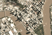
Natural Disaster Analytic Time Series QGov
A Queensland government restricted time series service (commenced 2018) that displays 16-bit spatial imagery over Queensland areas affected by natural disaster events captured from satellite, manned aircraft, or remotely piloted (drone) platforms.
.png?version=1&modificationDate=1632700515462&cacheVersion=1&api=v2)
Natural Disaster Optical Time Series QGov
A Queensland government restricted time series service that displays optical spatial imagery over Queensland areas affected by historic natural disaster events captured from satellite, manned aircraft, or remotely piloted (drone) platforms.
Active Natural Disaster Time Series QGov
A restricted time series service that displays optical 8-bit band-adjusted spatial imagery over Queensland areas affected by historic natural disaster events captured from satellite, manned aircraft, or remotely piloted (drone) platforms.
Elevation
| Note |
|---|
DEM basemap services contains LERC format tile_cache. At versions ArcGIS Enterprise 10.7.x – 10.9.x services containing LERC tile_cache do not display in ArcGIS Pro and Spatial Portal or ArcGIS Online Map Viewers, therefore please use the dynamic elevation services instead in these clients. |
DEM Latest Tile_cache (CLP Users)
A restricted, tile_cached elevation service that displays high resolution (where available), ortho Digital Elevation Model (DEM) data captured by LiDAR system installed on remotely piloted aircraft systems (drones), piloted aircraft, and the Shuttle Radar Topography Mission (SRTM) over areas of Queensland. This digital terrain model (DTM) represents the bare ground surface without any other objects like trees and buildings.
DEM Time Series (CLP Users)
An access-restricted time-series elevation service that displays the latest, highest resolution, ortho Digital Elevation Model (DEM) data captured by LiDAR systems installed on remotely piloted aircraft systems (drones), piloted aircraft, and the Shuttle Radar Topography Mission (SRTM) over areas of Queensland. This digital terrain model (DTM) represents the bare ground surface without any other objects like trees and buildings.