Topics in this section:
| Table of Contents |
|---|
Using Public Imagery and Elevation Services in MapInfo
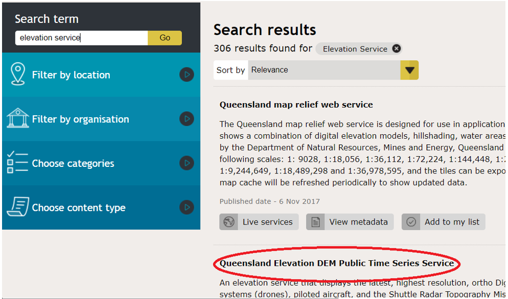
Open the Queensland Spatial Catalogue.
In the Search term search for elevation service and navigate to Queensland Elevation DEM Public Time Series Service
Click on Live services, find the WMS link press on Copy Link
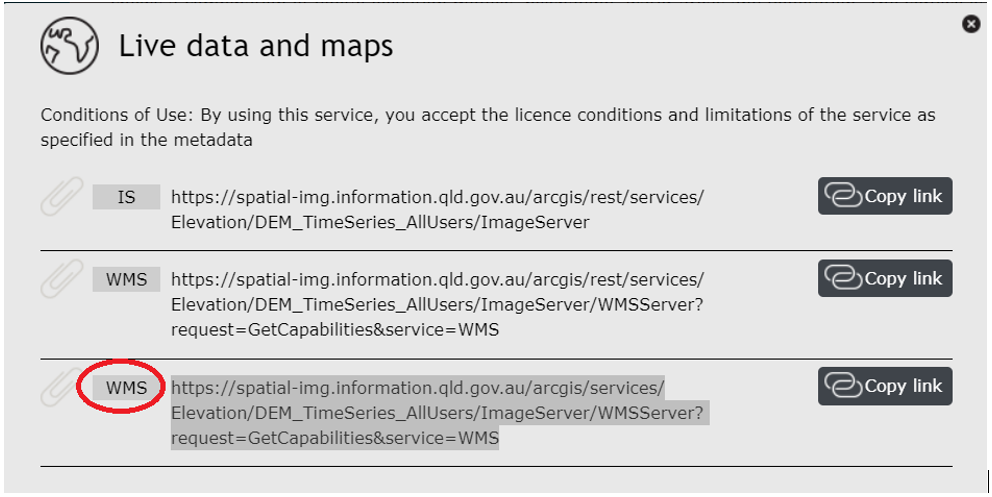
Copy one of the WMS services links above or below, i.e. Public Time Series DEM or Basemap:
| Code Block |
|---|
https://spatial-img.information.qld.gov.au/arcgis/services/Elevation/DEM_TimeSeries_AllUsers/ImageServer/WMSServer?request=GetCapabilities&service=WMS |
| Code Block |
|---|
https://spatial-img.information.qld.gov.au/arcgis/services/Basemaps/LatestStateProgram_AllUsers/ImageServer/WMSServer?request=GetCapabilities&service=WMS |
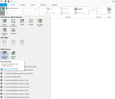
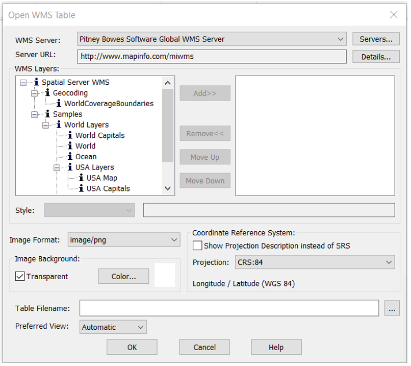
In MapInfo open WMS table.
Click on Services and paste the WMS link.
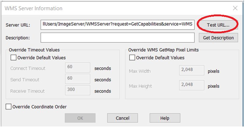
After pasting link, click on Test URL to make sure the test is working.
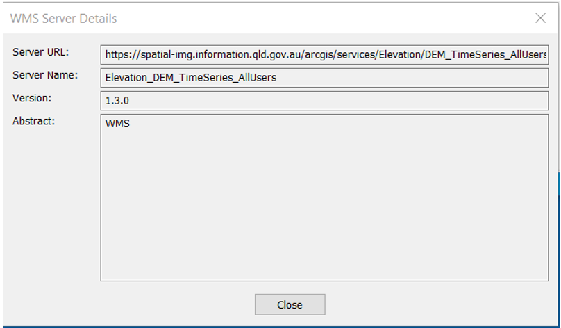
After testing successfully, the URL, below message will be appeared. Make sure to Get Description before adding the service.
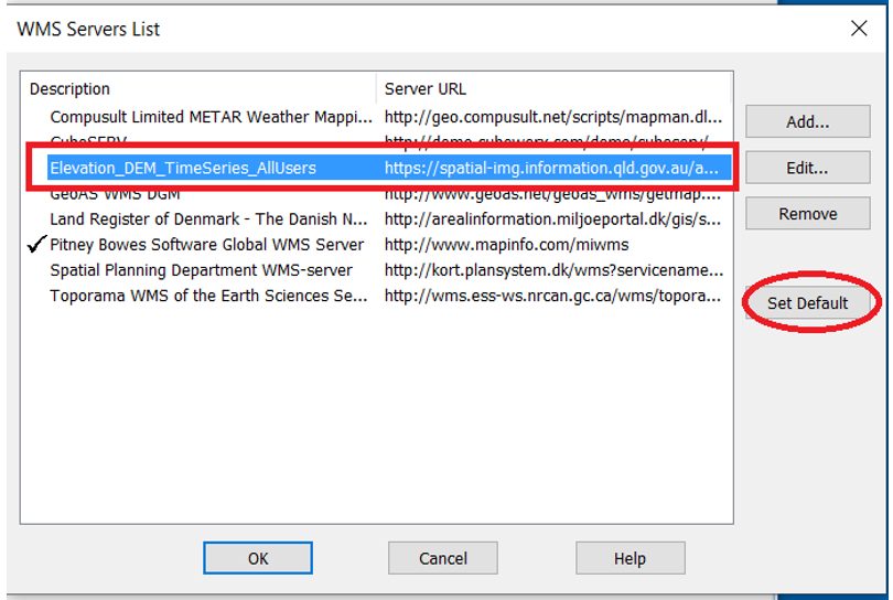
After testing the URL, click on Set Default to view the service
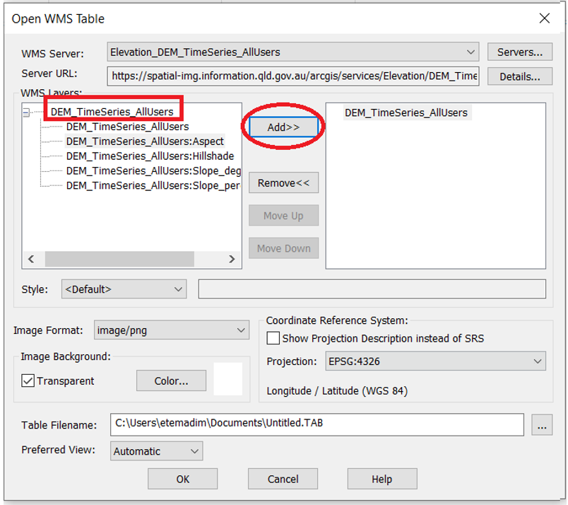
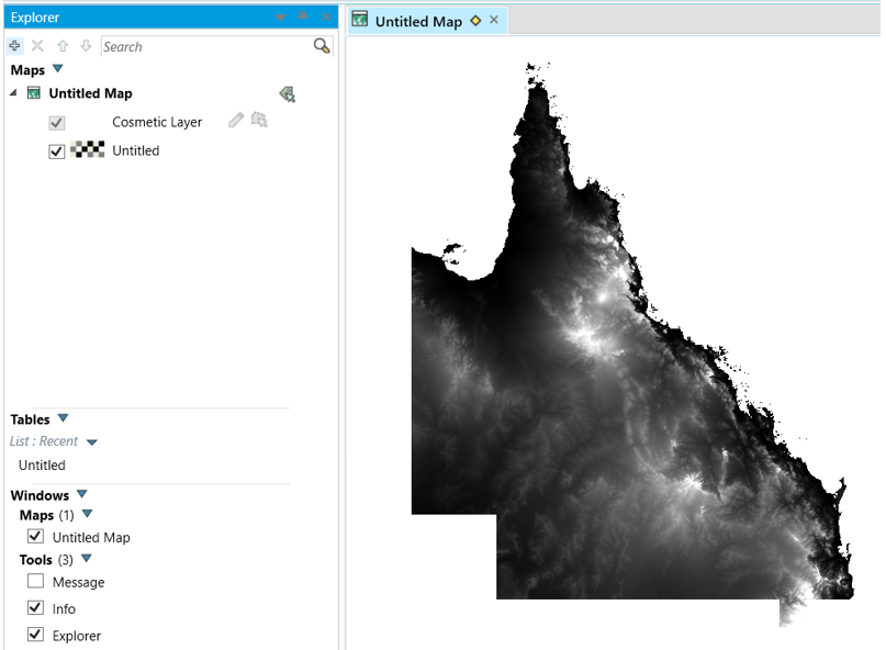
The DEM service includes 4 functions : Aspect, Hillshade , Slope_Degrees and Slope_Percentage
To add one or all available services or functions, click on add and hit OK to create TAB file
Using Restricted Imagery and Elevation Services in MapInfo
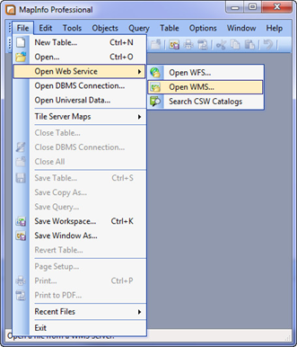
Open MapInfo. Click on the File menu, select Open Web Service, and choose Open WMS...
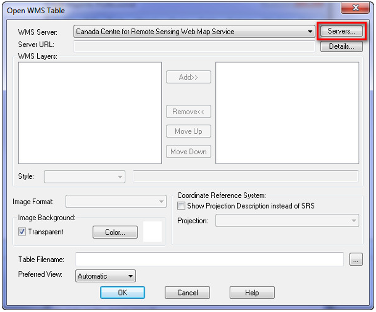
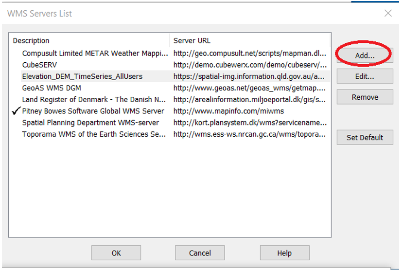
In the Open WMS Table window, click Servers...
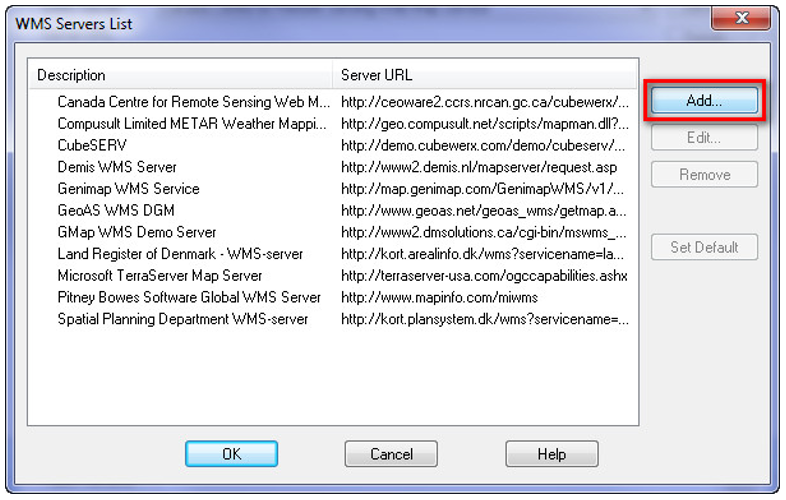
In the WMS Servers List window, click Add...
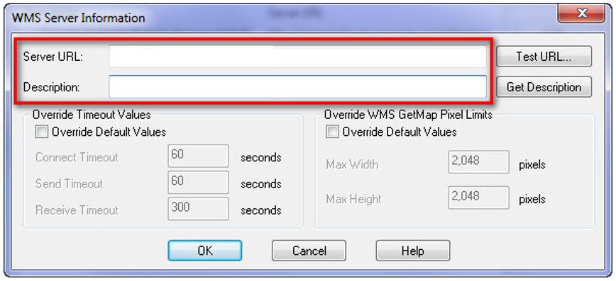
In the WMS Server Information window, enter the WMS URL as specified below with the Basic Authentication -auth prefix:
| Code Block | ||
|---|---|---|
| ||
https://auth-spatial-img.information.qld.gov.au/arcgis/services/Basemaps/LatestStateProgram_QGovSISPUsers/ImageServer/WMSServer? |
In the Description field add in a name so you can find the service next time you open MapInfo e.g. SISP Image service.
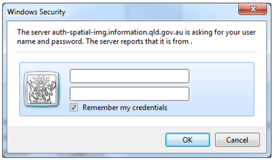
When you are prompted for authentication enter in your Spatial Portal Built in Account details provided to you by the Department of Resources State Imagery team:
In the WMS Servers List window, select the WMS you just added and click OK:
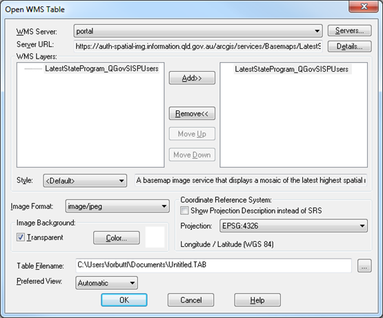
In the Open WMS Table window Select the WMS layer LatestStateProgram_QGovSispUsers and click Add>>.
In the Image Format field, select image/jpeg. This will substantially improve performance when compared with image/png. Then click OK.
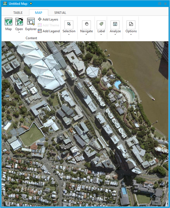
The requested service should now be loaded.